PFTrack Tutorials for Beginners
Your Guide to Camera Tracking Mastery
PFTrack tutorials for beginners provide you with essential tools to master camera tracking and matchmoving. Whether you're just starting or looking to refine your VFX skills, our tutorials cover everything from fundamental concepts to advanced techniques. Dive into these structured, easy-to-follow lessons and begin your journey to becoming proficient in PFTrack. Explore our resources today and take your first step toward VFX success!
PFTrack Tutorials

Hero Cloud — Tutorial
The new Hero Cloud node in PFTrack Version 26.05.14 generates high-quality dense point clouds from a single tracked camera move, with no LiDAR or additional capture hardware required.
PFTrack Tutorials
Master PFTrack Solo in 10 Minutes: Fast 3D Camera Tracking & Solving
New to PFTrack Solo? This 10 minute quick start guide takes you from project creation to 3D export. Master camera tracking, solving, and orienting with ease.
PFTrack Tutorials

Tutorial 01 - Introduction to PFTrack & creating a project
Learn how to create your first project, import example clips, and get a brief tour of the UI.
PFTrack Tutorials

Tutorial 02 - The basics of tracking & solving a clip
Learn the basics of how to automatically track and solve an example clip to enhance your VFX skills.
PFTrack Tutorials

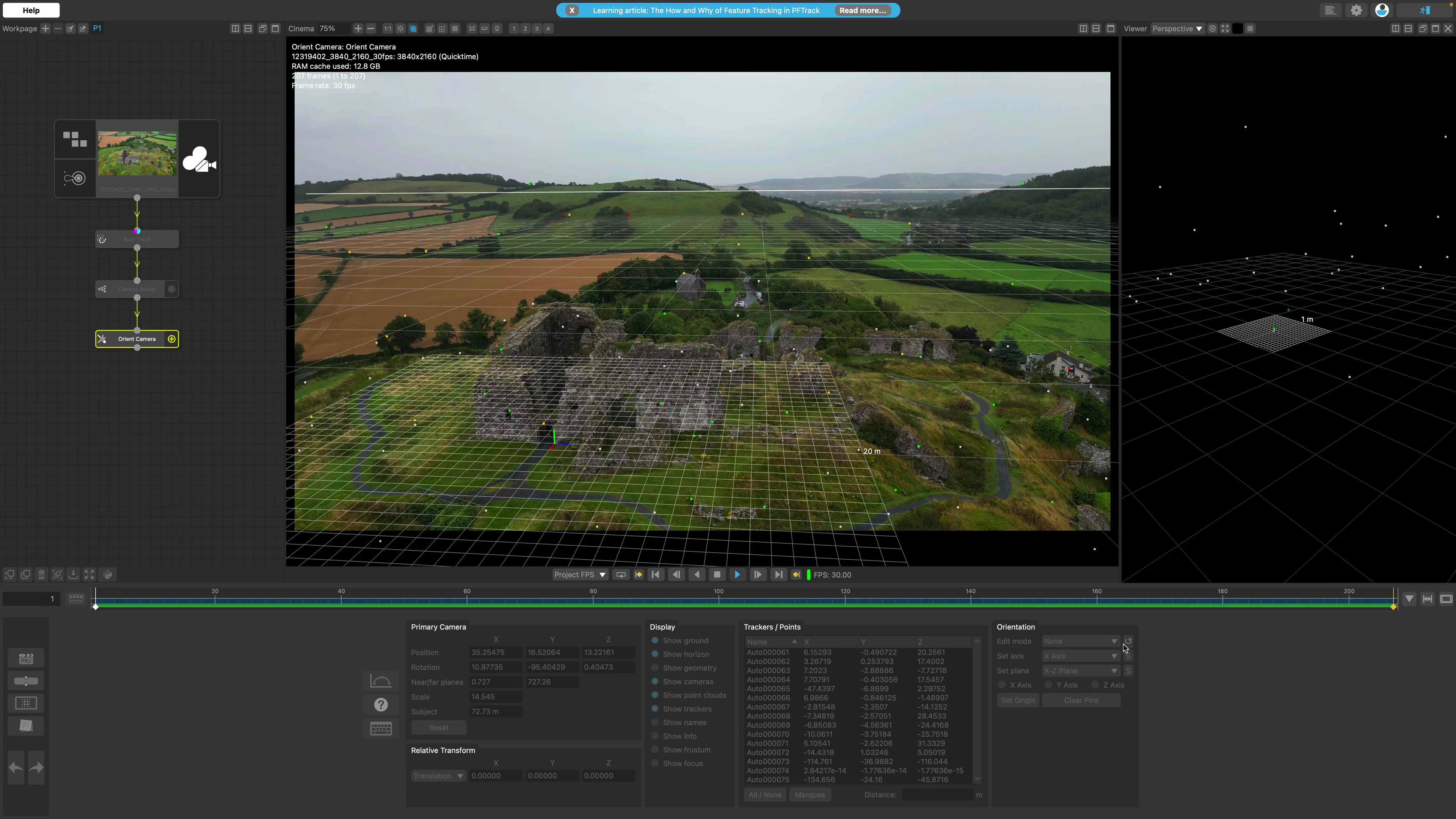
Tutorial 03 - Aligning the camera & exporting
In this video, we'll cover how to reorient your virtual camera, correctly scale your 3D scene, and export your completed 3D scene.

FAQ
PFTrack integrates drone-captured aerial imagery, ground-level photography, and terrestrial or aerial LiDAR datasets into a unified spatial intelligence platform. By combining the high-fidelity photographic textures of photogrammetry with the millimeter-accurate geometric data of laser scans, the software outputs highly precise, scaled point clouds and textured 3D meshes.
This hybrid spatial data serves as the absolute structural foundation required for Scan-to-BIM applications, allowing architects and structural engineers to seamlessly export accurate physical environments directly into major BIM and CAD suites like Autodesk Revit and Bentley iTwin.
PFTrack utilizes a node-based architecture that records every camera solve, data filtering step, and mesh generation process as a reusable, branching pipeline. This configuration eliminates manual repetition by allowing architecture and construction firms to apply the exact same validated workflow across hundreds of independent drone or ground-level surveys.
For continuous site documentation, teams can regularly process automated site captures, creating chronological 3D models to monitor project progress over time, flag structural deviations from the original design blueprints, and securely document true as-built conditions.
PFTrack supports a diverse matrix of industry-standard file types to ensure frictionless cross-platform data interoperability with building information modeling, CAD, and architectural visualization tools. Supported export formats include:
-
Spatial Point Clouds: PLY, USD, and traditional industry formats.
-
3D Geometry & Textured Meshes: USD, FBX, and OBJ.
This direct export capability ensures that captured spatial environments can be immediately ingested into downstream design, rendering, and architectural project management ecosystems without requiring tedious data conversion.
-
PFTrack constructs highly accurate digital twins of physical assets by combining multi-angle photogrammetry with advanced camera tracking. When handling video-based assets, such as drone walkthrough surveys or interior video documentation, PFTrack analyzes frame-to-frame pixel continuity to generate richer, more continuous spatial data profiles than pure, standalone photogrammetry programs.
Furthermore, because physical assets change over time, architecture firms can leverage PFTrack’s built-in Python API and Command Line Interface (CLI) to script automated batch-processing updates, refreshing the 3D digital twin whenever new visual survey data is uploaded.
FTrack offers flexible cross-platform compatibility and scalable licensing tiers designed to match the varied IT infrastructures of modern AEC (Architecture, Engineering, and Construction) organizations. The software runs natively across Windows, macOS, and Linux operating systems, ensuring seamless performance regardless of a firm's specific hardware deployment.
-
PFTrack Studio: A cloud-managed floating license system designed for multi-user teams. It allows floating seat allocations to be distributed dynamically to any machine via an online account dashboard (requires a persistent internet connection).
-
PFTrack Enterprise: The facility-grade deployment tier built for secure, high-stakes infrastructure projects. It utilizes a local PFBucket license server to distribute floating seats across internal networks, fully supporting offline and air-gapped environments that must comply with strict corporate data protection standards.
-